Nautical Charts
 Navigation charts, in digital or paper format, are the backbone of safe boating in congested areas and multi-use environments. Whether you prefer NOAA, MapQuest or Garmin. "Know Before You Go!" Click here to access an NOAA chart of the Battery, NY as well as their entire line up of charts.
Tides & Currents for NYC
 The waters of our Port flow in both directions every 6 hour cycle. Knowing this information is important to safe navigation. Our waters act in this way because our Port is an estuary. An estuary is a body of water where rivers meet the sea and salt meets fresh water. Positioned at the confluence of the Hudson River and many smaller rivers such as the East, Hackensack, and Raritan, the estuary opens into the New York Bight and Long Island Sound.
USCG Homeport
 Click here to access the USCG Sector NY Homeport site. It offers a comprehensive look at all activities in the Port of New York and New Jersey. Every thing from waterway closures to security zones to marine events it is a one stop shop for critical port info.
Stevens Institute Regional Maritime Data
 This amazing system is designed to provide a knowledge of meteorological and oceanographic conditions both in real-time and forecasted out to 48 hours in the Hudson River, the East River, NY/NJ Estuary, Raritan Bay, Long Island Sound and the coastal waters of New Jersey. It offers tides, currents water temps and salinity.
NOAA Marine Forecast
 This marine weather forecast is provided by NOAA and the National Weather service offering predictions and buoy observations for the coastal zone and waters around our area.
NY Waterway Ferry Route map
 New York Waterway operates comprehensive ferry transportation from points in NJ to and from Manhattan as well as an East River Ferry Service reaching Brooklyn and Queens. Ferry travel is a growing means of transportation in the NY Harbor and it contributes to the busy multi-user environment with increased wakes and an exacting schedule.
NY Water Taxi Ferry Route map
 New York Taxi operates comprehensive ferry transportation from Lower Manhattan to points in the five boroughs. Ferry travel is a growing means of transportation in the NY Harbor and it contributes to the busy multi user environment with increased wakes and an exacting schedule.
I BOAT NY Harbor
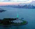 This helpful web site developed by long term NY Harbor live aboard resident, at 79th St Boat Basin, Ed Bacon offers some valuable recreational boater information. The goal of this website is to inform recreational boaters about many issues in this mixed-use urban harbor.
NYC Water trail map
 This map is primarily used by paddlers but serves as a useful tool for all boaters to be aware of the many boathouses, launching and landing points for the Human Powered Community in the Port. The New York City Water Trail connects 160 square miles of rivers, bays, creeks, inlets and ocean in the five boroughs suitable for kayaks, canoes, and openwater rowing craft.
North River Sailing Blog
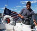 This sailing blog is a another comprehensive look at boating in the Harbor. It is largely dedicated to sailing in New York City and New Jersey, along the Hudson River and Upper NY Bay, it also includes a lot of waterfront information.
SUNY Maritime College
 SUNY Maritime College is educating the worlds next generation of maritime professionals as well as offers a variety of boater safety classes and programs.
GoBoatingNJ.org
 The objective is to provide boaters throughout the Region with accurate, current information on the condition of New Jersey's waterways. Since Hurricane Sandy came ashore in late October, reports of unprecedented destruction to marine facilities, navigation aids and channels left boaters wondering if there would be a boating season in 2013.
